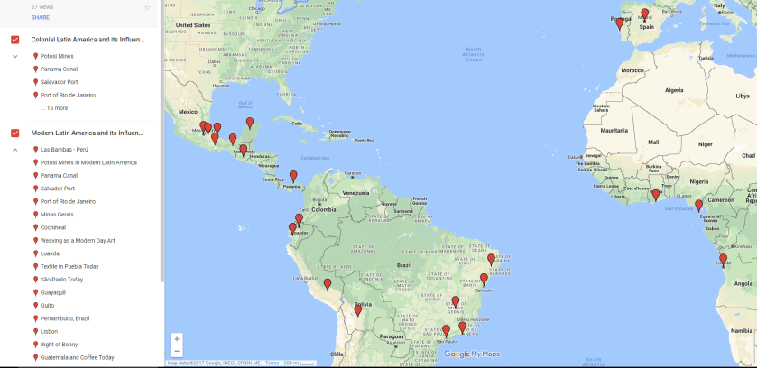
In an introductory survey of colonial Latin American history, I tried out a mapping project using a simple, free, online program. Objectives included thinking about the persistence and use of colonial spaces in the national period; analyzing changes and continuities to names of historical places, especially with regard to language; and locating sites of historical memory and national meaning. These broad goals seemed suited to Google My Maps, which is straightforward and requires only a little explanation and training. This tool allowed students to insert their analyses as descriptions to marked places, as well as create categories to distinguish time periods. Using information from the textbook and lecture notes to describe the colonial places, students then combined their knowledge with current news sources. Students were required to note the significance of the places they chose and describe relationships between places on their maps.
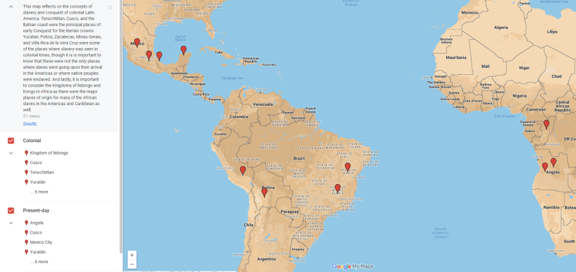
Students chose the themes of their maps, many of which explored the legacies of Atlantic trade routes. These examples show one project that reflected on slavery and forced migration (above), and another that took a more general view of the maritime and overland connections between West Africa, the Americas, and Iberia (below).

This assignment was easy to complete, in terms of the digital skill set needed, while promoting student learning and critical thinking in a key area of colonial Latin American history. The memory of colonial places and their continued use are important take-away points in my teaching. The same aim could be accomplished without using a mapping program, but I also believe that using relatively simple digital tools in an introductory class helps students visualize the impact of colonial places. Furthermore, digital assignments build confidence with technology alongside critical thinking, and possible collaborative projects.
